
File:Location Tawantin Suyu.png

Size of this preview: 800 × 370 pixels. Other resolutions: 320 × 148 pixels | 640 × 296 pixels | 1,357 × 628 pixels.
Laga ekifaananyi ekijjuvu (pikseli 1,357 ku 628 , bunene bwa fayiro: KB 36, kika kya MIME: image/png)
Summary
| Description |
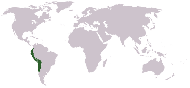
Runa Simi: Tawantin Suyu tarina saywitu.
English: Locator map of the Inca Empire.
Español: Mapa del Imperio Inca |
| Date | 2 Gwakusatu 2006 (original upload date) |
| Source | Own work |
| Author | Huhsunqu |
Origin
Português: Feito e carregado por Huhsunqu.
Runa Simi: Kaytaqa Huhsunqupam tiksishqan yapashqanpis, LocaciónTawantinsuyu.PNG nishqapita rurashqa.
Licensing
I, the copyright holder of this work, hereby publish it under the following license:
This file is licensed under the Creative Commons Attribution-Share Alike 2.5 Generic license.
- You are free:
- to share – to copy, distribute and transmit the work
- to remix – to adapt the work
- Under the following conditions:
- attribution – You must give appropriate credit, provide a link to the license, and indicate if changes were made. You may do so in any reasonable manner, but not in any way that suggests the licensor endorses you or your use.
- share alike – If you remix, transform, or build upon the material, you must distribute your contributions under the same or compatible license as the original.
Ebyafaayo ebya fayiro eno
Bw'onyiga ku nnaku n'essaawa, ojjakulaba fayiro nga bwe yali efaanana ku kiseera ekyo.
| Ennaku n'obudde | Kulingiza | Obuwanvu n'obugazi bwakyo | Eyakiteekawo | Okulw'ogerako | |
|---|---|---|---|---|---|
| oluwandika oluliwo kakano | 00:41, 19 Gwakkuminogumu 2006 | | 1,357 × 628 (KB 36) | Huhsunqu | World (more than 2'000.000 km2) |
| 16:20, 2 Gwakusatu 2006 |  | 250 × 200 (KB 6) | Huhsunqu | ||
| 16:15, 2 Gwakusatu 2006 |  | 250 × 200 (KB 5) | Huhsunqu | {{qu|Tawantin Suyu Saywitu}} {{es|Mapa de los terriorios/gobernaciones/provincias (suyukuna) del Imperio Inca}} Category:Inca Category:Former country locator maps ==Origen== Cretaed by Huhsunqu. First uploaded as [[:es:Imagen:LocaciónTawantinsuy |
Empapula eziriko enyunzi ezigguka ku kifaananyi kino
Tewali mpapula ziriko nyunzi ezigguka ku fayiro eno.
Global file usage
The following other wikis use this file:
- Usage on ca.wikipedia.org
- Usage on ckb.wikipedia.org
- Usage on cs.wikipedia.org
- Usage on de.wiktionary.org
- Usage on el.wikipedia.org
- Usage on en.wikipedia.org
- Usage on eo.wikipedia.org
- Usage on eo.wiktionary.org
- Usage on es.wikipedia.org
- Usage on he.wikipedia.org
- Usage on io.wikipedia.org
- Usage on mr.wikipedia.org
- Usage on nds.wikipedia.org
- Usage on nl.wikipedia.org
- Usage on pl.wikipedia.org
- Usage on pl.wiktionary.org
- Usage on qu.wikipedia.org
- Usage on ro.wikipedia.org
- Usage on simple.wikipedia.org
- Usage on sv.wikipedia.org
- Usage on ta.wikipedia.org
- Usage on ur.wikipedia.org
- Usage on yi.wikipedia.org
- Usage on zh.wikipedia.org