
File:Map of Georgia highlighting Jasper County.svg

Size of this PNG preview of this SVG file: 517 × 599 pixels. Other resolutions: 207 × 240 pixels | 414 × 480 pixels | 663 × 768 pixels | 884 × 1,024 pixels | 1,767 × 2,048 pixels | 4,437 × 5,142 pixels.
Laga ekifaananyi ekijjuvu (Fayiro ya kika kya SVG, ya pikselo 4,437 ku 5,142 awamu, ya obunene bwa: KB 432)
Summary
| Description |
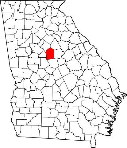
English: This is a locator map showing Jasper County in Georgia. For more information, see Commons:United States county locator maps. |
| Date | |
| Source |
Own work: English: The maps use data from nationalatlas.gov, specifically countyp020.tar.gz on the Raw Data Download page. The maps also use state outline data from statesp020.tar.gz. The Florida maps use hydrogm020.tar.gz to display Lake Okeechobee. |
| Author | David Benbennick |
Licensing
| I, the copyright holder of this work, release this work into the public domain. This applies worldwide. In some countries this may not be legally possible; if so: I grant anyone the right to use this work for any purpose, without any conditions, unless such conditions are required by law. |
Ebyafaayo ebya fayiro eno
Bw'onyiga ku nnaku n'essaawa, ojjakulaba fayiro nga bwe yali efaanana ku kiseera ekyo.
| Ennaku n'obudde | Kulingiza | Obuwanvu n'obugazi bwakyo | Eyakiteekawo | Okulw'ogerako | |
|---|---|---|---|---|---|
| oluwandika oluliwo kakano | 11:00, 12 Gwakubiri 2006 | | 4,437 × 5,142 (KB 432) | David Benbennick | {{subst:User:Dbenbenn/clm|county=Jasper County|state=Georgia}} |
Empapula eziriko enyunzi ezigguka ku kifaananyi kino
Empapula 1 ezikuggusa ku fayiro eno ze:
Global file usage
The following other wikis use this file:
- Usage on ar.wikipedia.org
- Usage on azb.wikipedia.org
- Usage on bg.wikipedia.org
- Usage on bpy.wikipedia.org
- Usage on cdo.wikipedia.org
- Usage on ceb.wikipedia.org
- Usage on ce.wikipedia.org
- Usage on cy.wikipedia.org
- Usage on de.wikipedia.org
- Usage on el.wikipedia.org
- Usage on en.wikipedia.org
- List of counties in Georgia
- Jasper County, Georgia
- Monticello, Georgia
- Shady Dale, Georgia
- Template:Jasper County, Georgia
- User:Nyttend/County templates/GA/1
- Category:Wikipedia requested photographs in Jasper County, Georgia
- Category:Populated places in Jasper County, Georgia
- Hillsboro, Georgia
- Adgateville, Georgia
- Aikenton, Georgia
- Prospect, Georgia
- Gladesville, Georgia
- Farrar, Georgia
- Usage on eo.wikipedia.org
- Usage on es.wikipedia.org
- Usage on et.wikipedia.org
- Usage on eu.wikipedia.org
- Usage on fa.wikipedia.org
- Usage on frr.wikipedia.org
- Usage on fr.wikipedia.org
- Usage on gl.wikipedia.org
- Usage on hu.wikipedia.org
- Usage on hy.wikipedia.org
- Usage on it.wikipedia.org
- Usage on ja.wikipedia.org
- Usage on ko.wikipedia.org
- Usage on la.wikipedia.org
- Usage on nds.wikipedia.org
- Usage on nl.wikipedia.org
- Usage on pl.wikipedia.org
View more global usage of this file.